blah blah blah
North Uncanoonuc Mountain
Length: 1.6 miles out-and-backDifficulty (click for info): Easy
Elevation Gain: 750 feet (+40 feet on return)
Rating (click for info): 5/10
Elevation: 1326'
Prominence: 766'
Driving Directions:
Trailhead and parking area are on Mountain Road in Goffstown, NH. Mountain Road takes off from Rt. 114 in the center of Goffstown, immediately south of where Rt. 13 comes in from New Boston and adjacent to the Cumberland Farms gas station. 0.9 miles down Mountain Road, bear left at the triangle junction, staying on Mountain Road. In another 0.5 miles, look for a very small pull-in parking space on the left with room for maybe a pair of cars. This will be right across from where the trail enters the woods. Click here for a Google map.
About the Hike:
Goffstown's two Uncanoonuc Mountains are a demarcation point on the horizon when viewed from afar. Being ten miles isolated from the nearest higher hill, the pair of round, low summits are recognizeable from almost anywhere. Though identical twins in shape (even being only a few feet apart in height), their major distinction is in development. While the south mountain is topped with an array of cell towers and houses, and formerly at various times throughout history, a fire tower, hotel, trolley, and ski area, the north mountain is mostly untouched by human activity. Views are not as extensive as those found around the perimeter of the south peak, but the north peak's summit does have the advantage of quietness. You can still enjoy some nice close-up views of its duplicate neighbor, as well as the city of Manchester.
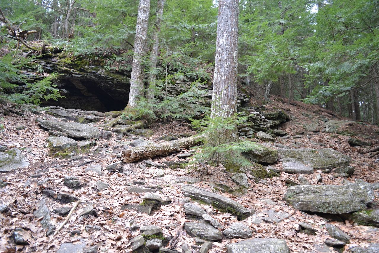
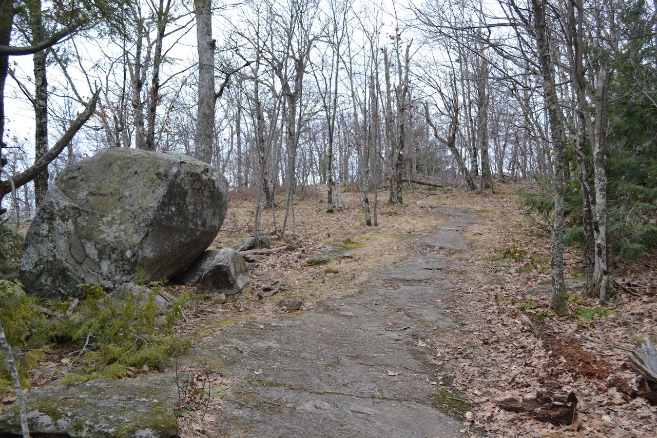
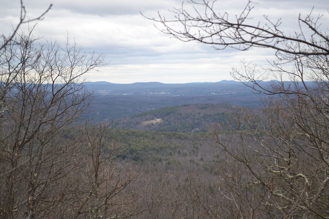
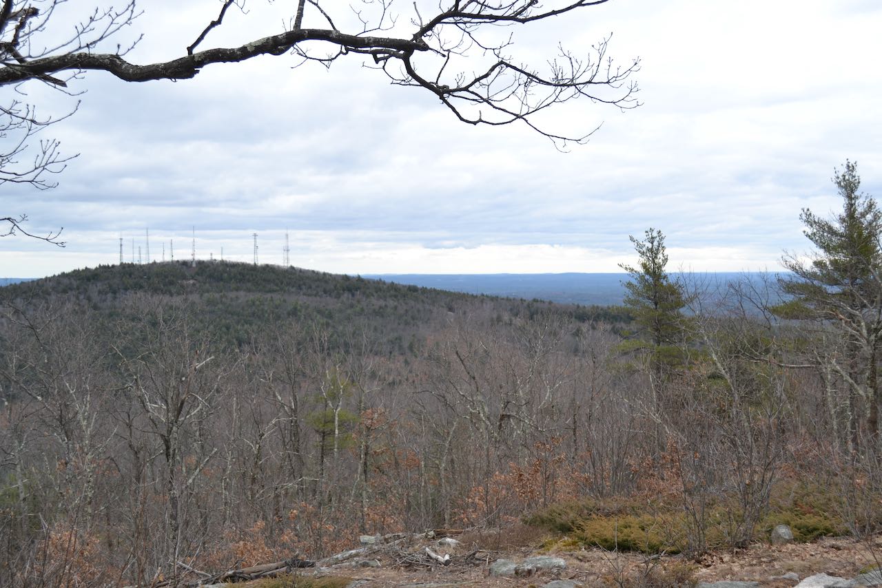
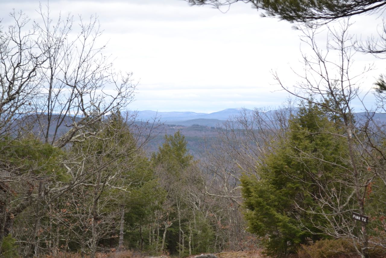
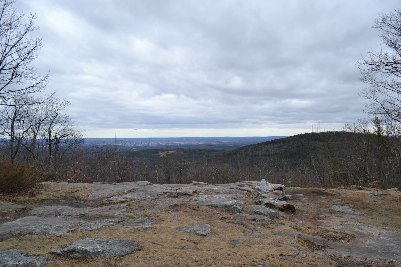
Starting from the small parking area for the White Dot Trail, cross the road and enter the forest, beginning the ascent immediately. Crossing a stone wall, a sign points the way. After a little over 0.1 miles, the trail climbs around to the right side of a mossy, layered ledge band with an overhang that forms an interesting cave. The trail steepens from here, climbing straight upslope as the trail surface becomes very rocky underneath dominating hemlocks. After half a mile from the base, at the top of a ledgy ramp on the trail, you can look back over the pathway to see a very narrow view to the north toward the Belknap and Ossipee Ranges. Beyond this, the incline begins to lessen, and the forest opens up and transitions to some beautiful grassy glades. The summit is approached in another 0.2 miles, as you stride along a veritable walkway of ledge. Just before reaching the open clearing at the top, notice a view off to the northeast on the left side of the trail, where you can see some of southeastern New Hampshire's notable peaks - from left to right, Saddleback Mountain, Hall Mountain, and the three summits of the Pawtuckaway Mountains. At the summit itself, the cleared-out viewpoint opens up to two major features - the city of Manchester and South Uncanoonuc. The flat rocks in the clearing are the perfect place to relax and pick out famous features downtown with a pair of binoculars. Some of the ledge outlooks you would visit on a hike to South Uncanoonuc are visible across the way just beneath the forest of communications and transmission towers. If you search carefully off to the right of the south mountain, you can see the Boston skyline in the distance on clear days. The best views are found here, but if you continue on the other side of the summit about 400 feet down the Red Dot Trail, you'll come to another semi-open area where you can peek through the trees in the direction of the Wapack Range and Mt. Monadnock.
Printable directions page